Drone Real Estate Photography
Aerials that show what an interior photo can't — lot size, waterfront, neighborhood context, golf course adjacency. FAA Part 107 certified, included in every package.
Why aerials sell waterfront and golf-course properties
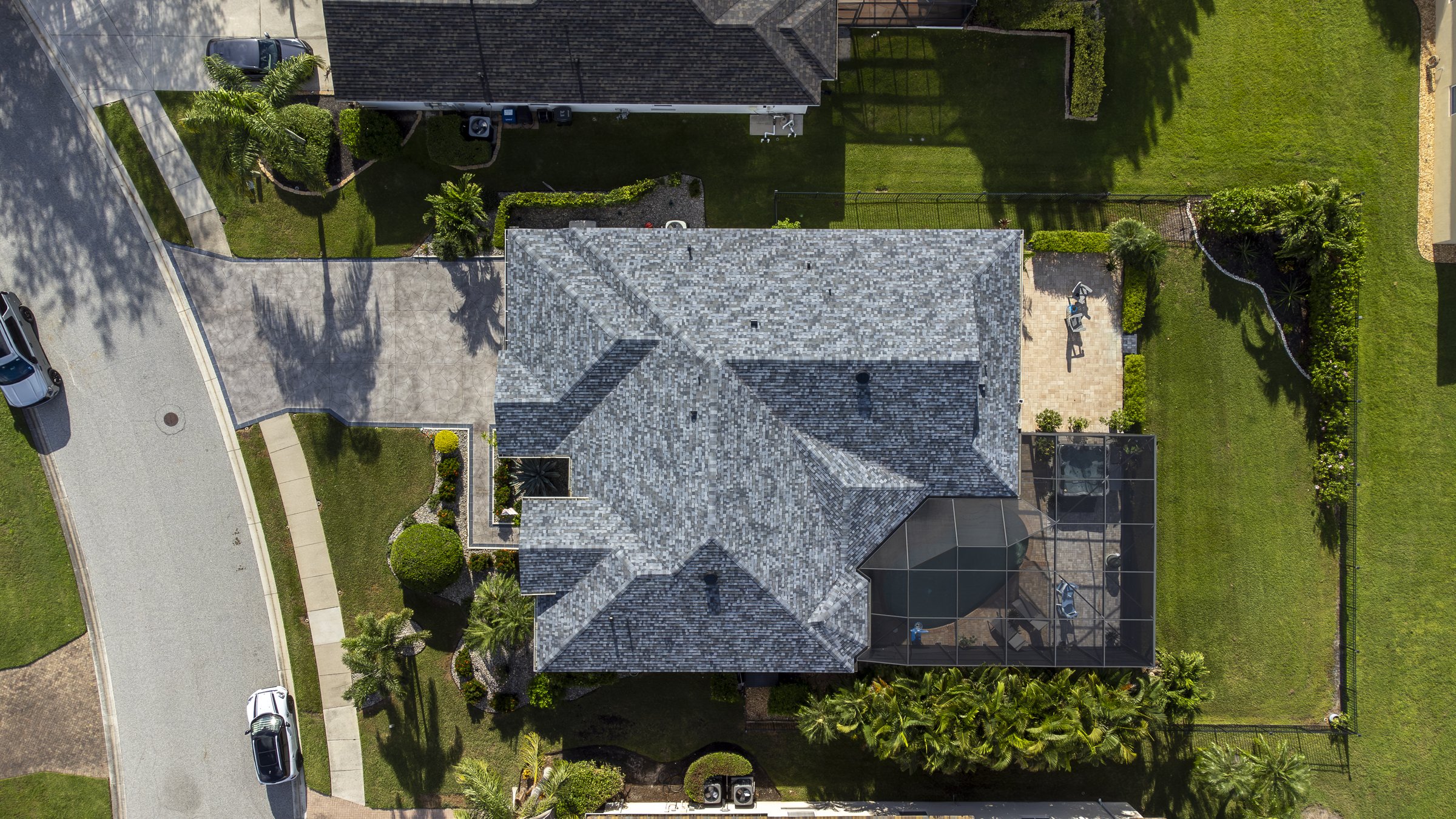
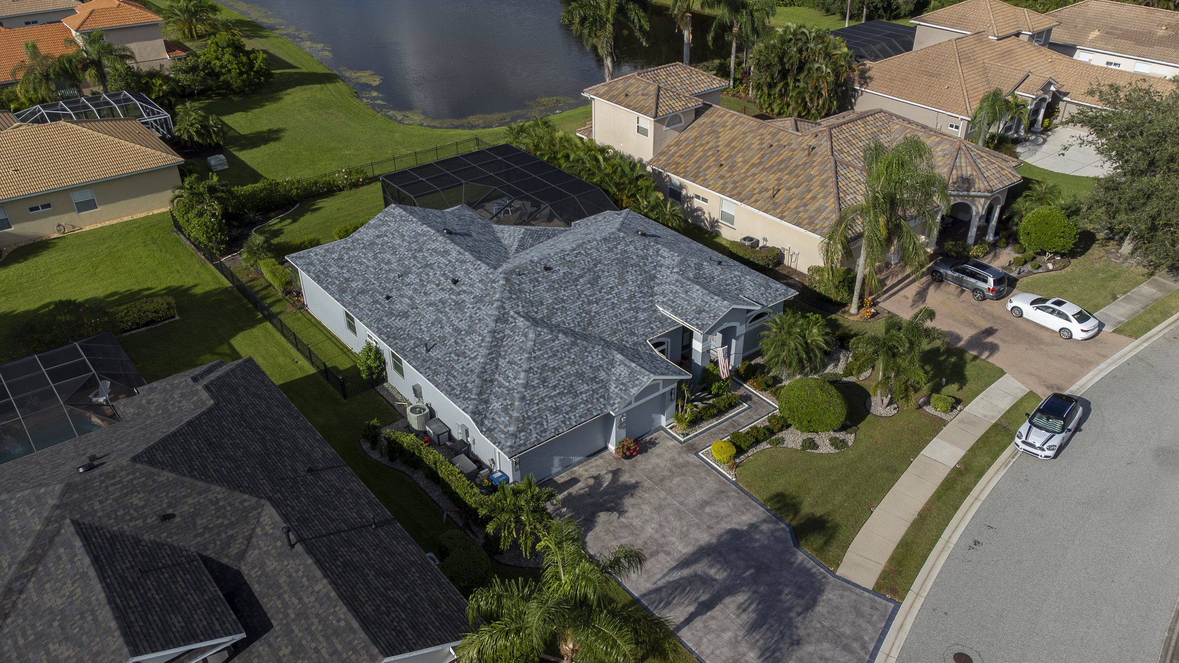
If your listing has a feature that doesn't fit in a window — a pool, a dock, a fairway view, beach proximity, a private drive — the ground photographer can't show it. Drone aerials can. A well-composed top-down or low-altitude angle communicates lot size, landscaping, and neighborhood context in a single frame.
Every LF Property Media package includes drone aerials. Signature gets 6 shots, Premier gets 10, Platinum gets 16. Add-on aerials are $20 each or $100 for a set of 5.
FAA Part 107 certified — what that means for you
Operating drones commercially in the United States requires FAA Part 107 certification. Locke holds this credential, which means we can legally fly for paid real estate shoots, we follow controlled-airspace regulations, and we carry the proper certifications to back it up.
If your listing is near Sarasota-Bradenton International Airport, Venice Municipal, or other controlled airspace, we file LAANC authorizations in advance so the shoot happens without surprises.
Shot list
- Top-down roofline — communicates square footage and lot shape at a glance
- Low-altitude angled facade — the hero shot, shows the home + landscaping
- Backyard / pool — outdoor amenities, screened cage, water features
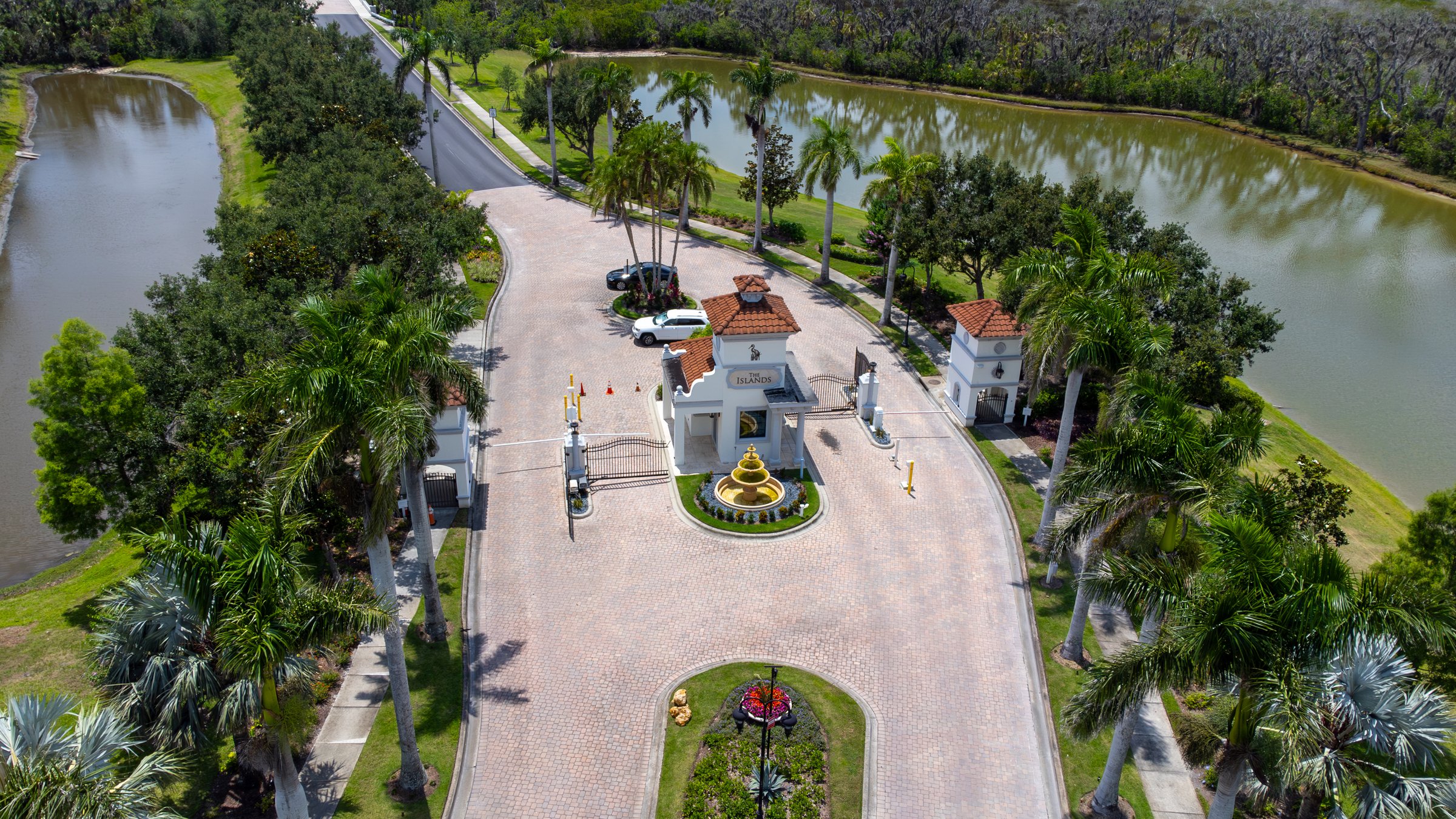
- Neighborhood context — proximity to Gulf, golf course, downtown, schools
- Waterfront / dock — for canal homes, boat slips, beachfront